



Lot n° 258
Estimation :
2200 - 2500
EUR
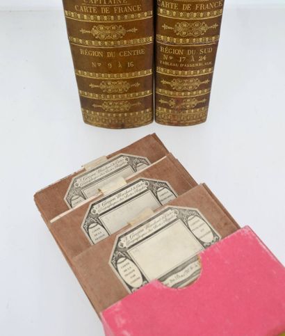
CAPITAINE (Louis). Carte de la France comprenant toutes les - Lot 258
CAPITAINE (Louis). Carte de la France comprenant toutes les mairies; divisée en départemens, arrondissemens et cantons. Paris, Goujon, 1816-1821. 24 leaves and 1 assembly map in 3 green half morocco boxes, richly decorated smooth spines, wide gilt border framing the boards.
New edition revised, enlarged, improved and enlarged beyond the Rhine and the Alps by the engineer-geographer Belleyme of the map of France drawn by Louis Capitaine, associate and first engineer of the general map of France by Cassini.
Important map of France first published in 1789 - 1790 by Louis Capitaine (1749-1803), with the administrative divisions of the Ancien Régime, which formed the basis of numerous derivatives until the mid-1880s. This is a quarter-scale reduction of the Cassini map, at a scale of 1:345,600. A very fine copy.
Expert : Madame Elvire POULAIN-MARQUIS
My orders
Sale information
Sales conditions
Return to catalogue